With no
major urban areas, Vermont has a small surface area of 9,614 square miles, with
an average of 67.11 people per square mile.
We crossed
through the Vermont’s capital Montpelier and drove in the direction of
Burlington. Located in the north-central area of Vermont and name after the
town in France, Montpelier is the seat of Washington County. The Vermont’s
state government, Montpelier is the least populous state capital in the U.S.
with a 2020 population of 8,074.
The most
populous city in Vermont (44,743) and the seat of Chittenden County, Burlington
is located 45 miles south of the Canada-U.S. border and 95 miles south of
Montreal. A typical college town, Burlington is home to Champlain College and
the University of Vermont. Globalists claim that Burlington is run entirely on
renewable energy since 2015.

Walking through Burlington’s Church Street and towards Lake Champlain, we encountered numerous homeless white people, a large contingent when compared to the population.


Burlington is so liberal and hateful against white people, that every business we walked past had posters and banners praising Black Lives Matter in every shop, including the pharmacy and bookstore. Everyone was praising the BLM movement yet there were no black people around to benefit from this alleged “protection and care.”

But none of the signs were so vitriolic as Ben & Jerry’s ice cream store which had a very large poster in the window, “WE MUST DISMANTLE WHITE SUPREMACY.” This sign was highly offensive to me, and it contradicted the front door message of “Peace, Love, and Ice Cream.” Selling ice cream with the lie of peace and love while threatening to dismantle the alleged “white supremacy” in America, is bizarre and distasteful to a Caucasian person like me who suffered many indignities at the hands of socialism run by the Communist Party.

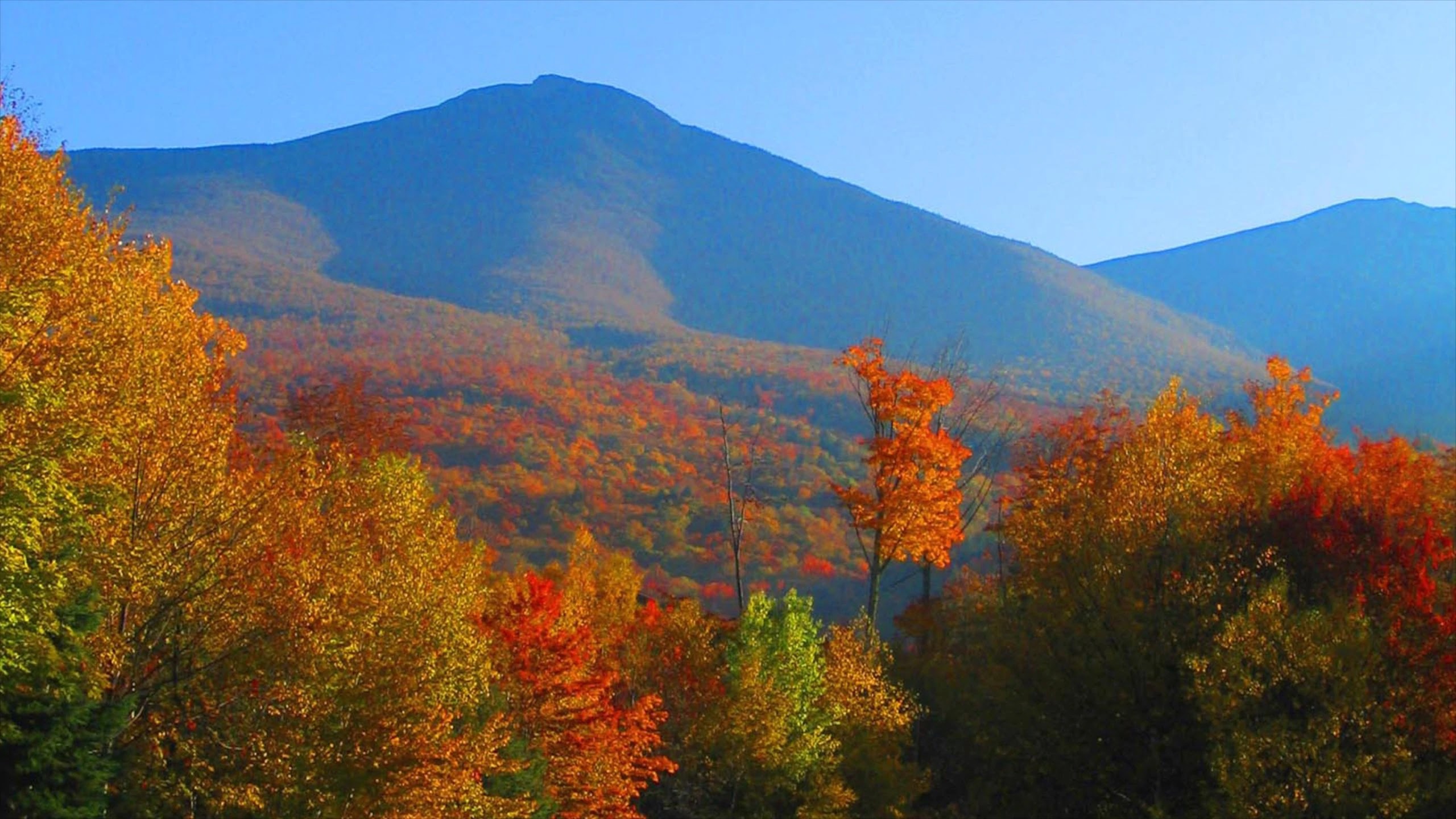
The day was cold but sunny and the leaves were turning beautiful hues of red and orange everywhere. An interesting detail we observed everywhere was that the population was white. The only evidence of black people in Burlington were two African women in a hotel lobby and a solitaire black man sitting on the steps of City Hall.
White college
students were gathered in groups talking or sitting around with their computers
and light backpacks. The mood of the people we encountered was unfriendliness
and disdain, a sort of, you are here now, but you are not welcome because you
are white like the rest of us, and you should feel guilty.
We encountered
nicer white people at a chain steak house and in the health-conscious grocery
store where we bought a few bottles of the famous Vermont (labeled organic)
maple syrup. And I wondered, if maple syrup is the sap of a tree, how exactly
is it not organic?

As we were pumping gas first thing in the morning, I noticed a free-standing and separate Kerosene pump. I have never seen a Kerosene pump in my 44 years of living and traveling across the United States. I assumed that they used Kerosene to heat their homes. Additionally, the sign on the pump urged customers to pay inside first due to the increased theft and high prices. Thieves, like the homeless, must be abundant in this socialist “paradise.” The question popped in my head, how exactly is Burlington run entirely on renewable energy since 2015, as they claim. Isn’t kerosene a “dirty” fossil fuel?
Burlington
is a typical college town with a strong odor of socialism. As a survivor of a
socialist republic run by the communist party, I was very uncomfortable in this
town, and I felt attacked by the many signs maligning the white race. I could
not wait to depart from such a place even though the landscape was beautiful.

The Democrat Party headquarters were located on Church Street, right next to the aptly named, The Red Café. There is no confusing the fact that this town is a communist RED town, a town populated by the politically ignorant, like most of the young supporters of Bernie Sanders, who advocate socialism over capitalism, without any concrete idea of what it is like to live in a socialist society where everything, including the means of production, are owned by the government run into the ground by the Communist Party.
Even the
church at the end of Church Street and Pearl was advertising a large yellow,
Black Lives Matter banner. There was no way to find a business or a government
building in downtown Burlington that did not pander to BLM.

We walked to the shores of Lake Champlain and watched the white ferry depart. I wished we could have taken the ride but, although sunny, it was very cold. As my mother always said, when referring to cold weather, it was a sunny day with sharp teeth.

The hue of blue water meeting the perfect sky was indescribable. The grass on the banks was luscious green and the trees were changing into New England’s fall palette. There were no flowers nearby, but a lost monarch butterfly flew around us for a minute and my husband greeted it with, “hello mom.”

By late afternoon, we were quite anxious to depart socialist Burlington, and drove for miles and miles through low country with beautiful dairy farms, meadows, and green pastures set against the backdrop of faraway blue mountains. The farms looked well maintained and the fields were green as far as the eyes could see. Pastoral images of dairy cattle grazing flew by our car windows.

We had quite a road trip ahead for the day, 326 miles to Scranton, PA via Albany, New York. We took a different route back as we did not want to cross through New York City again as we did on the way to New Haven, CT. We planned to spend the night in Scranton and to visit the Steam town Museum the next day.
Five and
half hours later Scranton greeted us with President Joe Biden’s interstate and
signs everywhere about Scranton’s beloved son who made it all the way to the
ultimate seat of power, the White House, and, judging by the many signs, made
this region quite proud.

Early next morning, on a chilly but sunny day, we joined twenty other visitors in the Steam Town Museum and railroad park. I was not sure what to expect but I was fascinated by the history, the display of steam engines, the depo, the railroad tracks, the history of railroad transportation in America, its significance to the rapid industrial development, and the demonstration of actual operational engines in the depot.

The steam engine changed our lives for the better, starting with how we traveled and how we viewed distances. For example, in 1812, a trip from Philadelphia to Pittsburgh took six days on a stagecoach. By 1901 the same trip by steam train took just five hours. Shipping goods, expand businesses, and visit loved ones became so much easier by train.

During the period of 1850-1860, there were more railroad tracks per square mile in this region than anywhere else in the country. George and Seldon Scranton, owners of the local iron foundry, made nails, spikes, and railroad rails to support these tracks. New England’s freight passed through the Lackawanna Valley.

The Scranton brothers established the Delaware, Lackawanna & Western Railroad (DL&W) which connected to the Erie Railroad and delivered iron rails to New York and later anthracite from their coal mining.

During the 1860-1900 period, the DL&W freighted (by 1874) ninety percent of the hard coal. Anthracite had become the preferred fuel for homes and businesses. During 1900-1907, the DL&W upgraded its fleet with longer and more powerful locomotives. This enabled railroads to carry large volumes of freight at low rates.
During the
period of 1912-1920 the dominance of coal began to decline by the end of WWI,
replaced by oil and natural gas. The federal government had nationalized the
railroads when the U.S. entered the war. To support this war effort, the nation’s
railroads burned bituminous coal. Industries and utilities still used anthracite,
but the federal government reserved oil for military use.
The use of
anthracite began declining by mid 1920s. Technology made oil and natural gas
popular alternative fuels. Anthracite use revived briefly during the Great Depression,
but it started collapsing into bankruptcy during the period of 1920-1940.
Cars,
trucks, buses, airplanes, pipelines, and barges contributed heavily to the
railroads’ decline. To make matters worse, DL&W acquired locomotive with
enormous tractive power, requiring less locomotives and many railroad employees
became unemployed.
World War II
revived the railroad industry and coal mining but the period of 1940-1960 experienced
developments that replaced the steam locomotive with Diesel engines, thus ending
many of the labor-intensive jobs of the steam era.
In October
1960, the DL&W merged with the Erie Railroad and the 3,031-mile
Erie-Lackawanna Railroad was formed. Six years later the passenger service was discontinued,
and the merger failed. Hurricane Agnes in 1972 was the final disaster and the
Erie-Lackawanna declared bankruptcy, its railroad remains being absorbed by
Conrail in 1976.
The rail
yard contains many locomotives, some still operational, and the Long Island
Railroad #193 Rotary Snowplow. A Canadian-invented plow designed to reduce the
cost of snow removal, this snowplow was built in 1898 and was used for
sixty-nine years until its retirement in 1967. A gigantic snow blower, it was
used to disperse snow on routes from Great Plains and western mountain ranges
where deep snow drifts were common.
One of the
fascinating details was the invention of Samuel F. B. Morse who typed in 1844
the world’s first telegraph message, “What hath God wrought?” over an
experimental telegraph line strung between Washington D.C. and Baltimore, MD.
The telegraph revolutionized long-distance communication and the operation of
railroads around the world.
As locomotives
became heavier and trains longer, railroad bridges had to be built in such a
way that would withstand strains and vibrations of heavier trains. In the late
1800s structural steel, a strong, light weight, and affordable metal was used
which allowed for the building of bridges and viaducts using semi-circular
arches, a design from Roman times. In the early twentieth century, “Built of iron
and steel reinforced concrete, these bridges and viaducts proved to be safe,
strong, and durable. Many still stand today.”

One such wonder was the Nicholson Viaduct. Located twenty miles south of the Erie Railroad’s Starruca Viaduct, it towers 240 feet above Tunkahannock Creek with ten 180-foot concrete arches and two 100-foot spans buried in the earth at each end. The viaduct is 2,375 feet long and it was built with 162,000 cubic yards of concrete, supported on eleven piers set in bedrock. After three years of construction, the viaduct opened on November 6, 1915, and it is still the world’s largest reinforced concrete railroad bridge.
After a
demonstration of a locomotive being brought out onto a rotating bridge and then
moved onto another rail in the yard, we left the museum with a feeling of loss –
such great giants of iron sitting forgotten in the rail yard, yet they have
contributed so much to our western civilization.
As anthracite
had been replaced by fossil fuels, Diesel, gasoline, jet fuel, cutting
railroads down to size, civilization has moved into the right direction, changing
our lives constantly for the better. But now the globalists are moving the
entire planet in the direction of replacing fossil fuels entirely by 2035 with
renewable energy which is nowhere near enough to supply our large economy. In
the end, our mobility will be reduced radically, and our standard of living
will decline drastically.
We concluded
our nine-day road trip to New England with the wish that smarter heads will
prevail in this insane and irrational war against fossil fuels. Gasoline has
helped drive us around for 1,700 miles to far away and beautiful places. Without
gasoline, our trip would have taken so much longer, constantly having to stop
to recharge an electric car, if we could have afforded to purchase one.
By the time we reached our home in Virginia, we had covered 1,700 miles through 12 states, Virginia, Maryland, Pennsylvania, Delaware, New Jersey, New York, Connecticut, Rhode Island, Massachusetts, New Hampshire, Maine, and Vermont.