Showing posts with label Virginia. Show all posts

Friday, May 17, 2024

Outer Banks Adventure

Our Outer Banks adventure started in Kitty Hawk, NC. OBX, which is what most people call the Outer Banks, is a 200 mile stretch of barrier islands off the coast of southeastern Virginia and North Carolina. This magnificent string of island pearls separates Currituck Sound, Albemarle Sound, and Pamlico Sound from the Atlantic Ocean which is rough and unpredictable on any day and the water temperature is 58-degree Fahrenheit in May.

Our journeys are never just vacations, they are adventures of discovery, finding amazing jewels of geography, places of wonder, nature, reflection, introspection, memorials, forts, and our country’s rich history. We seek memories that enrich our souls, eyes, and minds.


We experienced the Atlantic Ocean’s fury enough to build a healthy fear and respect for the watery giant. My daughter and I were covered in black silt by the rough waves and my husband was picked up by a riptide and slammed onto the ocean floor, suffering cuts, abrasions, and bruises on his forehead and right shoulder. When he emerged from the bottom, he was bleeding from his injuries but lucky to be alive.

The beaches are lovely, with endless dunes covered in grasses, colorful blanket flowers, and sand crabs scurrying across into their hiding holes, but the water is so rough that only experienced surfers dare to enter the waves. Hundreds of skate egg black casings washed up on the yellow sand each morning. The Atlantic Ocean is quite different from the placid Gulf of Mexico in Florida with its sugary crystal white sand and emerald, green waters.

Cape Hatteras National Seashore represents the area’s rich biodiversity. Trees, shrubland, and beach grasses keep the ecosystem alive. Birds, turtles, rabbits, and other creatures inhabit the islands. Shackleford is home to a herd of wild horses just like further north on Corolla Island. I am not sure if the horses are from the same group that washed or swam ashore from the Spanish galleon five hundred years ago. Wherever they came from, they thrive here on their own just like on Corolla Island. There are no homes on Shackelford but there are homes behind the dunes on Corolla. Humans and wild horses share adjacent spaces and the beach without any problems.

Roanoke Island is famous as the site of the early English settlement of the United States where the Roanoke Colony vanished in 1587, including the first English subject born on the island, Virginia Dare, which lent her name to the Dare County and many other geographical points of interest. I am sad to say that the infamous Roanoke Colony which was left behind for three years without supplies and protection before the governor returned, is still missing.

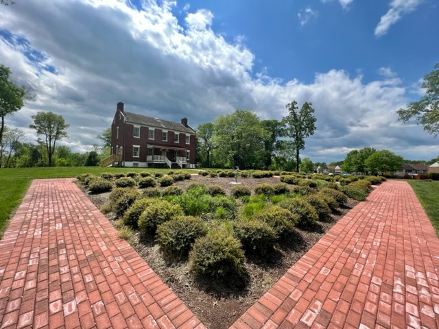
Roanoke Botanical Gardens

Roanoke Island displays a monument on Fort Raleigh, First Light of Freedom, marking the existence of the Freedmen’s Colony. After the Union forces occupied the island in 1862, Roanoke Island became a haven for black families from the region and a Freedmen’s Colony was established there during the war.

The Outer Banks area has a darker name, the Graveyard of the Atlantic, on account of the more than 600 shipwrecks, victims of shallow sandbars, dangerous storms, shoals, and war, who lost their cargo and crew in the rough seas.

A shoal is a ridge, a bank, or a bar made up of sand or other shifting material, close to the surface or above it, which can create a dangerous situation for navigation and thus sink many ships loaded with cargo. One such cargo was, 500 years ago, released onto the ocean and it drifted or swam to the shore. Since then, wild Spanish horses make Corolla Island’s beaches and marshes their home.

The turbulent ocean off Cape Hatteras sank many seafarers who risked these dangerous shoals to take advantage of the north- or south-flowing currents nearby. Hurricanes drove many ships aground. Other ships were lost in wars. The waters in this area were also called Torpedo Junction during WWII when German subs sank many Allied tankers and cargo ships. So many lives were claimed by the rough waters in this area!

The day we took the ferry from Cape Hatteras to Cape Lookout and Shackleford Islands, it was cloudy, chilly, and drizzly. We were the only passengers going to the islands, but several locals returned with us at dusk, on the last ferry ride of the day. We found the two islands peaceful; Shackleford looked deserted and lonely save for the wild horse herd; Cape Lookout Island had a tropical feel of a castaway island with a strange silence and utter loneliness sort of way even though there was evidence everywhere of human care and maintenance.

Kitty Hawk Memorial on the hill

The famous photographer immortalized on the spot 

Kitty Hawk was the place where the Wright brothers first took flight in their plane on December 17, 1903. A monument high on the hill commemorates their achievement and the actual location of the plane is adorned by a life-size flying machine and a statue of the witnesses and of John Daniels who happened to take the perfect picture of the lift-off. 

On the field of Kill Devil Hills, they mounted an engine on a 40-foot, 605-pound flyer with double tails and elevators. During the four tries, the brothers took turns at the controls. With Orville at the controls, on the first try, the flyer was aloft for 120 feet but, on the fourth try, with Wilbur at the controls, it traveled an impressive 852 feet in 59 seconds. What a remarkable feat to fly like the birds!

Cape Lookout Beach

The Outer Banks are made up of islands, shoals, and spits from Ocracoke Island northward. The beaches south of Cape Lookout are called the Southern Outer Banks. Our adventure ended at Cape Lookout on a cloudy day, with intermittent raindrops on the island and over the ocean.

Shackelford Island

These Outer Banks islands formed millions of years ago from sand dunes, after the melting of the Earth’s glaciers without any help from humans or their man-made global warming. They separate the Atlantic Ocean from the mainland North Carolina and protect the shores from raging storms and damaging waves.

The largest islands are Bodie Island (now a peninsula due to tropical storms and hurricanes which closed inlets that had formerly separated it from the Currituck banks), Pea Island, Hatteras Island, Ocracoke Island, Portsmouth Island, and the Core Banks. Over time, the number of islands and inlets changed due to closing or opening of inlets during violent storms, the gradual shifting of sands called beach evolution.

Mom and her philly

Corolla swamps where the wild horse herd lives

Majestic black stallion

Harem enjoying the beach on Corolla

A harem walking single file on the beach on Corolla

We did not start in Sandbridge in Virginia Beach where it is said that the line of the Outer Banks starts, we started instead in Kitty Hawk, NC. “Road access to the northern Outer Banks is cut off between Sandbridge and Corolla, North Carolina, with communities such as Carova Beach accessible only by four-wheel drive vehicles” like the Hummer which took us on Corolla Island safari to see the Spanish wild horses which roam the marshes and the beaches unafraid of humans, stallions tending to their harems.

The herd has about 126 wild horses which survive on their own without human intervention, feeding off the oat grasses. They are smaller than domesticated horses and arrived on this island from the Spanish galleons which wrecked on the shoals five hundred years ago. Occasionally stallions are found injured from fighting each other and, if necessary, the vets will intervene to save the injured animals, but they are never returned to their previous habitat after being cared for by humans.

People disagree as to where the Outer Banks end. Most agree that the Outer Banks include Cape Hatteras, Cape Lookout, and Cape Fear. Others limit it to Cape Hatteras and Cape Lookout with coastal areas in four counties, Currituck, Dare, Hyde, and Carteret. “Some authors exclude Carteret County’s Bogue Banks; others exclude the county entirely.”

The Outer Banks are constantly shifting and suffering erosion by storms as there are no coral reefs to anchor them to the mainland. One example was Hatteras Island which was cut in half by Hurricane Isabel in 2003 by a 2,000 feet wide and 15 feet deep channel running through Hatteras Village. Sand dredging repaired the damage and, in 2011, the U.S. Army Corps of Engineers repaired a similar disaster.

There are three main highways that enable visitors to reach the Outer Banks: NC 12, US 158, and US 64. NC 615 is the main route along Knotts Island in the extreme north where it connects only to Virginia by land.

Three state highway bridges connect the Outer Banks to the mainland:

-    1. The Wright Memorial Bridge, the oldest built in 1930 (US 158 between Point Harbor and Kitty Hawk)

-    2. William B. Umstead Bridge, second oldest built in 1957 (US 64 between Manns Harbor and the mainland and Manteo on Roanoke Island)

-    3. Virginia Dare Memorial Bridge, newest, finished in 2002 (US 64 Bypass between Manns Harbor and Roanoke Island between Manteo and Wanchese)

Roanoke Island and Nags Head are connected by US 64 and the Melvin R. Daniels Bridge. All three main highways of the Outer Banks (NC 12, US 158, and US 64) meet at Whalebone Junction.

Bald cypress in Duck

Our favorite tourist destination was the village of Duck with its quaint and diminutive feel of old-world charm. The Duck Town Park stretches for 11 acres of trails through maritime forest, willow swamp, open green spaces, sound side views, and access to the Duck Boardwalk. The six-mile-long Duck Trail traverses the entire length of town.

As we drove through village after village, ghost forests marked the landscape now and then, evidence of previously coastal forests lost to repeated exposure to saltwater due to hurricanes and drought. They had turned into a salt marsh habitat with dead tree trunks and stumps, an eerie sight found throughout Down East Carteret County and many low-lying NC shorelines.


Fort Macon is an example of the need for coastal defense. The region around Beaufort was very vulnerable to attacks and especially Beaufort Harbor, North Carolina’s only major deep-water ocean port. Blackbeard and many other pirates passed through Beaufort Inlet at will. Beaufort boat repair displayed ballast stones that were recovered from Queen Anne’s Revenge, Blackbeard’s most important ship which sank off the coast.

The war of 1812 showed the weaknesses of existing coastal defenses and the need for a fort in this area. Fort Macon was designed by Brig. Gen. Simon Bernard and built by the U.S. Corps of Engineers in 1826-1834 for a cost of $463,790 to guard Beaufort Inlet and Beaufort Harbor. According to the Archives, Fort Macon only had one ordnance sergeant acting as caretaker stationed by the Army at the fort.


Driving back to Virginia, we came upon the small waterfront town of Plymouth on the Roanoke. Founded in 1787, this tiny place that time forgot boasts a black bear festival every first Saturday in June and 4 bears per square mile. We drove for 45 minutes through unpaved roads with signs to not disturb the bears and all we saw was a couple of bear scats. The bears were asleep in the trees dotting the landscape between crop fields. It is true that Coastal NC has the world’s largest black bears, and the Albemarle/Pamlico Peninsula has the highest black bear density in the world, but we did not see any bears. Some beautiful specimens were taxidermized in the Bear-Ology Black Bear Museum in Plymouth. The glossy brochure welcomed us to Bear-olina. But the musty smell of the museum, however interesting, chased me away.

Cape Lookout Island Lighthouse

Our week-long remarkable adventure the length of beautiful NC barrier islands (OBX) came to an end, with regrets of places we missed like Portsmouth Village and Ocracoke. Ocracoke required a two-hour ferry ride one way, and the water was too rough to undertake such a long oceanic ride.

Sunday, February 11, 2024

Fort Monroe

A visit to Newport News, Yorktown, and Jamestown, Virginia are important steps in tracing the history of our United States.

In 1607 Captain Christopher Newport searched the land of the Kecoughtan tribe.  His exploration brought English colonists to the New World. They named the area Cape Comfort before moving up the James River to settle at Jamestown.

Captain James Smith, who surveyed the area between 1607 and 1609, believed it to be an ideal place for a fort.

During the War of 1812, British soldiers burned Hampton and occupied the Old Point Comfort Lighthouse.  The British Navy sailed unopposed all the way up the Chesapeake Bay to Fort McHenry in Baltimore, burning Washington, D.C., along the way.


President James Monroe saw the importance of establishing fortifications on the eastern seaboard so that no ships could pass again through and come within range of Washington to burn the city down.


President James Madison hired a French engineer, Brevet Brigadier General Simon Bernard, to design a network of coastal defenses to protect the nation from future attacks.

Initial planning was made in 1817 for Fort Monroe, the largest of these fortifications. The construction for Fort Monroe was decided near the point where the Chesapeake Bay meets Hampton Roads, a natural deep-water channel that made it a critical defense site.


The actual construction of Fort Monroe began in 1819. During the early 1820s, construction required the delivery of 800,000 bricks per month. These bricks were produced within a mile of the fort. Granite was brought from quarries along the Susquehanna River in Maryland. The main fortification was completed in 1834.

Jefferson Davis, President of the Confederate States, spent time in this casemate May 22- October 2, 1865, as prisoner of war, before he was moved to Carroll Hall in the fortress; he remained there until May 1867 when he was released on bail and never brought to trial.


Brevet Brigadier General Simon Bernard was a member of the French Army’s Engineer Corps and former aide-de-camp to Napoleon. Marquis de Lafayette recommended the general to President James Madison and Gen. Bernard arrived in the U.S. in 1816. President Madison placed Bernard at the head of the Board of Engineers, which was charged with constructing coastal defenses, forts, roads, and canals.


Climbing to the top of the fort gave us a breathtaking view of the Chesapeake Bay. A pet cemetery circled the ramparts which I thought a bit odd.

Friday, April 28, 2023

Liberia House in Manassas, Virginia

Liberia House stands in the middle of a beautiful green pasture, a flower garden, a cemetery, a walking trail with a brook surrounded by woods and an apiary, with buzzing busy bees covered in pollen. The locust trees are just blooming and greening.

The Weir cemetery at the bottom of the hill is shaded by a lugubrious tree in the corner, leaning at a 45-degree angle and exposing its roots like a trailing mantle, delivering the nutrients of plant life. Not even sunshine can make this tree look inviting in this symphony of early spring colors.

If Liberia House could talk, it would enumerate an endless list of famous and ordinary Americans who have walked through its doors: Jefferson Davis, Abraham Lincoln, Gen. P.G.T. Beauregard, Gen. Joseph E. Johnston, Gen. Irvin McDowell, and countless unknown soldiers who were wounded in the Civil War and sought refuge and care in Liberia.

The house was built in 1925 by W. J. Weir on land formerly owned by “King” Carter. It was Gen. Beauregard’s headquarters from May 1861 until after the First Battle of Manassas, July 21, 1861.


According to archives, Jefferson Davis “watched the First Battle of Manassas on July 21, 1861, and then came here to Gen. P.G.T. Beauregard’s headquarters to meet with him and Gen. Joseph E. Johnston before returning to Richmond on July 23. Lincoln came here with his Secretary of War on June 19, 1862, to visit Gen. Irvin McDowell, who was recovering after his horse fell on him.”


During restoration of Liberia, numerous signatures were found on the walls on the second floor, written by Union soldiers stationed here. They wanted to be remembered; that they were alive in that moment in time. A graffiti from March or August 1862, written by Pvt. Adam McKelvey, Co. G. 12th Pennsylvania Infantry Reserve Regiment, can be found among others who signed their names for posterity, knowing that death was stalking them.

Liberia was the place where the Weir family raised their children and grandchildren. The plantation was so vast, it encompassed most of the land of Manassas today. There were slaves in bondage here, and “a beer baron from Alexandria operated a dairy farm on the property.”


An archive photograph from 1862 shows Liberia with an intact kitchen wing on the right. The museum curators believe that it was probably destroyed during the war and never rebuilt.

Liberia’s owners, William James Weir, and Harriet had planted daffodils alongside the front walk of the house. A photograph from March 1862 shows the yellow blooms when the house was occupied by Union troops. The daffodils somehow survived the encampment of two armies amid the Civil War.

The Turberville Memorial Garden today is planted with common plants in Virginia that are supporting pollinators of the current apiary.


William J. Weir complained to Confederate soldiers early in the war about the loss of his fruit trees. In 1863, an edition of Harpers New Monthly Magazine reported that Weir was said to have been ‘shut up in the guardhouse for saying, as he witnessed his fruit trees being made into firewood, that he didn’t know as he would be used any worse by the Yankees than he had been by those who professed to be his friends’.

Private George Bagby of Virginia’s 11th Infantry wrote in 1861 during his time in Liberia: “At night I would walk out in the garden and brood over the possible result of this slow way of making war. The garden looked toward the battlefield. At times I thought I detected the odor of the carcasses, lightly buried there; at others I fancied I heard weird and doleful cries borne on the night wind.” (Museum Archives)


The Weir family owned 2,000 acres of farmland and forest so far from settled areas that it required barns, a dairy, a gristmill, a laundry, a kitchen, slave quarters, a school, a general store, and a post office. The labor to maintain such a vast plantation was provided by “enslaved and white laborers and skilled craftsmen, alongside members of the Weir family.” They lived here for thirty-six years.


During the Civil War, the family was divided. William did not want secession, but his three sons served in the Confederate Army. The family moved to Fluvanna County. Walter inherited the property after his father’s death in 1867 but the farm never returned to its pre-war wealth.


Before the City of Manassas acquired the property in 1986, records show that:

1.      The property owned by William Weir encompassed most of modern-day Manassas (1825-1888) – Library of Congress

2.      Liberia was a dairy farm when owned by Alexandria businessman Robert Portner (1888-1947); the Portners never lived on the property  – Manassas Museum Collection

3.      Liberia was owned by the Breeden family (1947-1986) – Manassas Museum Collection

There is evidence from an ad placed in 1847 in the Alexandria Gazette that William Weir operated the Liberia Mathematical and Classical School on the premises.  A donation to the museum of a math exam with the words at the top of the page, ‘Liberia School,’ became further evidence of the school’s existence.


Walter Weir 

The Weir Cemetery appears too close to the house; that is because it was moved here in 1989 from its original site, Point of Woods East/Lakeside. With the family’s permission, 24 graves and headstones were moved by specialists at the Smithsonian Institution according to the original burial plans and plots. The exhumation revealed that only Walter’s remains were well preserved because he was buried in a cast iron coffin with a glass viewing pane. Walter’s body was so well preserved that forensic analysis revealed that “he died from an infection, likely caused by an abscessed tooth.”

Note:  Museum archive photos are black and white, color photographs: Ileana Johnson April 2023


Sunday, April 19, 2020

Collecting Parking Fees in Virginia's State Park


This is how parking fees were collected in Leesylvania State Park on April 15, 2020 by order of Governor Northam of Virginia, the most draconian Covid-compliant state. As a socialist dictator, Northam will not open businesses in Virginia until June 10, 2020, the last state in the union to do so.

Saturday, June 1, 2019

The Woods Still Stand Witness to Our History


Trail to Freestone Point
Photo: Ileana Johnson, May 2019

Leesylvania’s woods and hills met me with a lush green embrace of solitude and peace and the drifting fragrant smoke of the waterfront barbecue grills. The thick forest lies on a small peninsula overlooking the Potomac and Occoquan Rivers, rich with American history, fauna and flora.
Leesylvania is now a state park with a fishing pier and a picnic area much beloved by Central American residents and their families. The laughter of children bathing in the Potomac River echoes through the thick forest. Some of the mature trees giving us a welcoming cool shade grew first as tiny saplings in the Lee family garden.

The bumpy hill leads up to the Confederate gun battery, the gravesite where Henry Lee II and his wife Lucy Grymes were buried. Closer to the bottom of the hill are the chimney remains of the former home of the Fairfax family.  Henry Fairfax purchased the property from the Lee family in 1825 and lived there until 1910.

Fairfax home chimney  

The Freestone Point, named after the porous quarried rock, juts out over the Potomac River, overlooking the current park’s fishing pier. On rainy days, tree roots ooze out mud below, washed out by a sudden deluge.

Confederate guns were placed here during the Civil War. In the early years of the war, General Robert E. Lee ordered a blockade of the Potomac River in order to cut off the Union’s access to Washington DC. The 32-pound cannons positioned here were part of the blockade that lasted almost six months.

Freestone Point drawing (Park archives)

The well-preserved northernmost battery at Freestone Point was used as a decoy while more effective batteries were placed down river at Possum Point, Cockpit Point and Evansport.

When in September 1861 Freestone Point was fired upon, Sgt. Walter Curry of the Washington Mounted Artillery of Hampton’s Legion wrote in his diary, “… as soon as the eleventh shot was fired, our Guns opened on the Lincolnite men of war which were floating majestically on the Broad Potomac.” The Confederates closed the commercial traffic on the Potomac by December. The blockade did not end until March 9, 1862.  (Leesylvania State Park Archives)
Close to the cemetery there are traces of the Alexandria and Fredericksburg Railroad tracks that used to carry necessary supplies to run a large estate growing corn and tobacco.

No trace remains today of the Lee’s ancestral home. Henry Lee II raised eight children here with his wife Lucy Grymes, including Light-Horse Harry Lee—Revolutionary War colonel, Virginia Governor, and father of Robert E. Lee. The Lees have left their imprint in the history of these lands and in the names of our modern landmarks.
Richard Lee, the original immigrant from England, was so determined to succeed in the New World that he became, in less than twenty years, an affluent fur trader, a colonel in the Virginia military, and a planter with prosperous land holdings and slaves. He owned fifteen thousand acres of land, more than any other man in the colony of Virginia. He was the colony’s attorney general and a member of the House of Burgesses.

In his old age, the “original Immigrant” returned to England, but his heirs were to come back to northern Virginia upon his death. Subsequently, generations of Lees made their homes and fortunes in Virginia after 1664.

Henry Lee II received from Henry Lee’s will in 1746 all his plantations and land in Prince William County at Freestone Point and at Neapsco (now called Neabsco, Doeg Indian for Point of Rocks) and Powell’s Creek.

The tobacco growing on the plantation was so lucrative that it was shipped to London from the wharf in Dumfries, three miles down from Freestone Point. Dumfries was the commercial hub in Prince William County. Today it remains the oldest incorporated small town in Virginia.

Henry II married in 1753 a “lowland beauty” named Lucy Grymes who is said to have been so popular with men of marrying age, she even became the object of marital aspirations of a young boy named George Washington.

Henry II cleared the land in Prince William County and built a new estate, Leesylvania (Lee’s Woods) the same year he married Lucy.  Modest by standards set by other plantations in the colony of Virginia, Leesylvania was built of brick on a stone foundation, with “double-tiered porticos wrapped around the front and rear of the building,” with twin chimneys, “two and half stories tall.” The home burned in 1797 and there is no image left of it.

Henry Lee was “the first citizen of Prince William County” in his capacity as its attorney general and militia commander. Washington asked him in 1755 to provide 100 men on horseback from Prince William County and bread provisions to “assist in the protection of our Frontiers.”

Henry Lee III monument

Lucy and Henry Lee lost their first child, a daughter. A year later, in 1756, another child was born of their union, Henry Lee III, a son who eventually became the famous Light Horse Harry (1756-1818). A statue at the foot of the rocky hill commemorates the revolutionary war hero and father of General Robert E. Lee.

View of the Occoquan River from the forested bluff
Photo: Ileana Johnson
Henry Lee III grew up riding horses, raising ponies, fencing, and practicing his marksmanship. Influential Virginians were frequent visitors at Lee’s Woods, dining and lodging there, including George Washington on his frequent trips from Mount Vernon estate to Fredericksburg and Williamsburg. (Ryan Cole, Light-Horse Harry Lee, The Rise and Fall of a Revolutionary Hero, 2019)

Henry Lee III was a cavalry commander (1776-1781), was awarded Congressional Medal in 1779, member of the Continental Congress (1786-1788), governor of Virginia (1791-1794), and member of the U.S. Congress (1799-1801).

Walking through the dense forest trails, I am in awe as my steps retrace the long-gone steps of so many famous American men and women who blazed this path through history, instrumental in the shaping of our country today.
Field of Dreams in Leesylvania State Park
Photo: Ileana Johnson


Monday, May 13, 2019

Virginia, Fairfax County, Education, and Trailers


Virginia is an interesting educational and political study in how to destroy a formerly well-off state with tolerance and multi-culturalism dictated by politicians from Richmond and Washington, D.C. It is a microcosm of the civilization suicide that is taking place in Europe.

Virginia is not very far behind the Seattle School District that sent a letter recently to teachers asking them to bless Muslim students in Arabic during Ramadan. Virginia obsesses over accommodating those who will not give an inch in their quest to be a specially protected class.

The Guardian wrote that “Virginia students learn in trailers while the state offers Amazon huge tax breaks.” And the unhappy teachers went on strike in January 2019 to express their dissatisfaction with what they saw as low pay, $9,000 less than the national average, while the state of Virginia was so generous to Amazon. https://www.theguardian.com/us-news/2019/jan/27/virginia-teachers-strike-amazon-tax-breaks?CMP=share_btn_fb The Washington Post published data from the National Education Association that the average K-12 teacher earned $58,353 in 2016-2017. https://www.washingtonpost.com/news/answer-sheet/wp/2018/03/05/how-much-or-little-teachers-earn-state-by-state/?noredirect=on

According to the Guardian, “more than 22,000 students in Fairfax county [the third richest county in America] receive their education in cheaply constructed plywood trailers, often with visible signs of green mold, like those parked next to the baseball fields next to McClean High School.”

McClean is a rich area in NOVA where the average homes cost over a million dollars. The property tax base to help fund public schools is thus very large.

Quoting school board member Ryan McElveen, the Guardian wrote, “Our staff often likes to say that Fairfax Public schools is the largest trailer dealer on the east coast. We own 820 trailers, more than any other entity on the entire east coast.”

Gov. Ralph Northam proposed to increase the education budget by approximately $270 million. Teachers objected to Northam’s proposed $750 million expenditure to lure Amazon to build its second HQ in Virginia, while classrooms were overcrowded, necessitating the use of trailers.

Why is there such an overcrowding in northern Virginia’s schools?  It is certainly not because Americans are having more babies, far from it, it is because illegal aliens have so many anchor babies that we are educating for free.

Educators are the first to push the liberal agenda of flooding the country with illegals whose children must be educated in their own native language, often dialects that require financial investing in specialized translators, teachers, textbooks, classes, and special tutoring, at the expense of American children who must learn in trailers and make do with less.

These new illegal arrivals must be also be fed at taxpayers’ expense and illegal families must be sheltered in welfare housing and provided with everything they may need to survive, including free and expensive healthcare.

Some teachers believe that giving tax breaks to Amazon is wrong when they could teach so many more illegal aliens’ children instead and house their families at the expense of the Virginian taxpayers.

Local and very vocal liberals in Fairfax county, who push for more school funding, argue that “building new schools could actually create more jobs than bringing in Amazon.” More schools mean more teachers and a lower teacher-to-student ratio argues Lee Carter, a Democrat Socialist state delegate from Manassas.

Northern Virginia (NOVA) with its progressive and corrupt political atmosphere is the reason why the entire state of Virginia is turning socialist. Republicans barely control the House of Delegates by only one delegate and the Senate by two Senators.

The NOVA population is composed mostly of federal government workers from Washington, D.C. and an ever-growing and very large contingent of illegal and legal aliens who vote Democrat as a block because they want to turn Virginia into the socialist paradise they’ve fled from.

Fairfax County Public School has adopted highly controversial curricula on sex education, sidestepping the important role of parents to teach their own children about human sexuality.  FCPS agenda was transgenderism and co-ed bathrooms.

The state education budget and local property taxes fund the public schools but is the money being used judiciously?

FCPS, with its budget of $3 billion annually, focuses more on globalism, with graduates who have “…attributes of Communicator, Collaborator, Ethical and Global Citizen, Creative and Critical Thinker, and Goal-Directed and Resilient Individual.”

Next year’s proposed budget increase of $117 million will “provide excellence and equity, hiring more staff to teach 1,000 fewer students.” According to Arthur Purves, “FCPS has a Chief Equity Officer but not much equity.” https://thebullelephant.com/Fairfax-county-public-schools-excellence-for-a-few/


Saturday, February 17, 2018

Smart, Switch, Sweat, and Shiver

The federal government in Canada has moved to pass coal phase-out legislation into law with its Just Transition Task Force in favor of “clean energy.”
“The end of coal power will help usher in a new era for renewable energy,” said David Suzuki Foundation director of science and policy Ian Bruce. “With conventional coal-fired power officially headed for the history books, people across the country can literally breathe easier about the future of energy production.”

“This is yet another signal that dirty, outdated energy sources are on their way out,” said the Foundation’s lead climate campaigner and senior policy analyst Gideon Forman. “Canada will now join a handful of leading industrialized countries such as the U.K., the Netherlands and France in accelerating the end of coal power worldwide – and the onset of clean, renewable energy.” France uses mostly nuclear power to generate their electricity.
Clean energy sounds great, especially nuclear and gas, but wind and solar electricity production, at the current rate of production and cost, cannot possibly replace all the energy needs of the planet for the industrial and public energy sectors.

Rationing electricity via smart meters which turns off power during peak electricity use and now Smart Cooling Rewards are ways in which the global warming advocates are forcing people to do without electricity in order to save the planet from a manufactured global warming catastrophe renamed climate change which we used to call seasons.
It is hard to convince people to give up their civilization, air conditioning, refrigeration, cars, central heat, and other amenities that make life more comfortable. They were bribed or forced to install smart meters on their homes. But people fought back and many states now have opt-out programs.

They tried to force people out of their cars by narrowing roads, bulldozing parking lots, building high-rise, mixed use tiny apartments, limiting suburbia with regulations and fines, and charging ungodly tolls of $46.50 to go 10 miles on I-66 to Washington, D.C. But Americans find ways around this global warming piracy because they love their cars and the freedom which the open-wide roads given them.

Private-public partnerships now scalp the public, working against the public interest and for the globalist investors’ interest. Governments, whether local, state, or federal, despite their claims, do not know what works best for their citizens.
Virginia citizens fought back and won the right to keep their standard meters, protecting their privacy, lower electricity cost, and their health. Dominion Energy recently came up with another scheme to control electricity consumption, Smart Cooling Rewards. The rewards are $40 at the end of each year that a household volunteers to participate in the program.

What is the program about? Dominion Energy installs “a switch on or near the outside of your air conditioner or heat pump system.” How convenient and generous, $40 for the privilege to sweat to death in summer time or freeze to death in winter time when the mother ship decides to cut off your power in order to save them the headache of having to buy more expensive electricity during peak seasons or perhaps build excess capacity storage.

“The switch enables us to automatically ‘cycle’ your central air conditioner for a few hours when electricity demand is highest, helping to reduce demand when it counts most,” says Dominion Power.
Utilities buy electricity annually during low season when the weather is mild and electricity is cheaper; they buy it in a lump sum by estimating their future electricity needs. If the load on the power grid is higher, then they have to buy more electricity at the market price when prices are higher. Some utilities may go as far as helping their customers weather-proof homes during free inspections, and giving them rebates if they comply.

“During periods of high electrical use, Dominion Energy Virginia may call an ‘event’, which means we will cycle your air conditioner or heat pump compressor on and off for defined intervals. The fan will stay on circulating already cooled air. The switch is programmed to cycle your AC unit half of the time it ran preceding an event. If your AC runs non-stop the hour before an event, then it will run 30 minutes for each hour of the event duration. This is accomplished by running 15 minutes on, 15 minutes off. At the end of the event your AC returns to normal operation.” 
It is entirely up to you how much you are willing to sweat or shiver in order to save your power company money and save the planet from a non-existent Armageddon that the global warming alarmists world-wide have been promoting.

This “switch” installed by Dominion Energy will be nothing but another smart meter that will control your energy use since the air conditioning puts the biggest load on electricity use. Why don’t utilities pass costs onto consumers? Is this bribe only about saving costs to them? Could it be possible that it is a way to control the non-cooperating first world people who love their A/C and other modern conveniences that environmentally conscious globalist elites condemn?

According to electricians, the electric grid is not in really good shape, it is a patched job that sometimes results in brown outs and black outs, especially in metropolitan areas that have grown extensively. The grid has not kept up with this expansion and the electricity loads are more than the grid can handle. It is a lot cheaper for utilities to turn power off than to redo the grid.

Will building the smart power grid be safer and will it handle electricity loads better than the existing conventional power grid? According to experts, changing everything to a smart grid will not be any better in terms of load other than the fact that those in charge will be able to turn your power off as they see fit. Additionally, hackers will be able to interrupt service maliciously. There is always the potential of a solar flare or the explosion of an EMP in the atmosphere that would fry everything.

Smart grids, smart meters, and smart switches will also allow utilities to spy on its customers without a warrant in terms of energy consumption, types of appliances they have, when owners are and aren’t home, and then sell other data about your home to an interested third party. Thieves can also easily find out when you are and aren’t home.


Wednesday, September 13, 2017

Mississippians Are Resilient People

My azaleas in Mississippi
Photo: Ileana Johnson 2004
As a resident of Mississippi for thirty years, I learned that living in the tornado alley close to Tupelo meant that downpours, high winds, and spun-seemingly-out-of-nowhere tornadoes were a weekly occurrence during hurricane season.

The first tornado I experienced took down part of the only mall in Tupelo and caused severe damage in its vicinity. The hit sometimes looked like a surgical strike and other times it downed an entire patch of forest on Natchez Trace, skipping and jumping to other locations for miles. We had straight line winds that often caused more damage than some tornadoes did.

During my tenure at the local university, most of the old trees, including a beautiful and venerable magnolia were uprooted. Several buildings, including dorms, were so severely damaged that they had to be torn down and rebuilt. Students were missed in their beds by mere inches by flying lamp poles or huge tree branches, and cars were smashed by falling trees.

I will never forget looking out of the window at the menacing clouds in the distance, watching my neighbors’ son get out of his car and, before he entered his parents’ house, one of the very old trees lining the street fell with a loud grown on top of his car, flattening it into a pancake.

Spotted tornado alarms would go off every week and people had to seek shelter in the bathtub or, as in our case, in the tornado shelter built inside the garage. The former owner, a doctor, thought that it was a good idea to place the water heater in it as well. I know he planned it because I found the architect’s drawings in the hall closet.

Living in the country for a while, I witnessed tornadoes do a lot of damage to trees and at times unlucky cows were struck by lightning or picked up by the wind cone – sometimes they were dropped nearby, sometimes we never knew where they went until other neighbors would find them dead or alive.

Living in trailers in the south was an entirely novel experience for a European like me – I’ve never seen one before.  During high winds and tornadoes, the tin can on wheels, although anchored well, rattled and lifted up as if trying to fly like Dorothy’s house in the Wizard of Oz. During sun-shiny weather bees, mice, and other critters found their buzzing and stomping grounds inside the thin metal shell and thin insulation.

We survived Katrina simply because we lived on higher ground and many hours inland but the wind damage was tremendous. Our sturdy house was built in 1960 when construction was a serious business, and homes were not built of spit and toothpicks.

We lived for three weeks without electricity and covered in 60-year old pine trees that fell around our home and into the street. The loneliness and despair stemming from the devastation around us was overpowering.

An entire town in the southern part of Mississippi was razed from the face of the earth as if it had never existed. Only concrete slab foundations and pipes jutting out of the ground remained. The media did not cover that disaster much because the attention was entirely focused on New Orleans and the people self-trapped in the stadium.

Mississippians, churches around the state, and the Salvation Army, sprang into action and started sheltering people, feeding them, providing water, cleaning up the incredible mess, and rebuilding quietly and efficiently in the same manner they’ve been fighting the force of nature for ages.

My next door neighbor shot himself in his bedroom. He had mental issues and the damage from the storm and the loneliness was too much to bear. Someone bought his house for pennies on the dollar because nobody wanted to live in a house where such tragedy occurred.

Mother Nature with its spun tornadoes did not care that it was a really hot or a really cold season, it left us without water and electricity for days and weeks. We stayed in hotels, showered at the gym, and helped other people do the same.

We lost refrigerators and freezers full of food many times over. I can’t remember how many times I’ve owned microwaves and TVs struck by intense lightning; one microwave I was attempting to buy from Sears cost me one penny – they could not find the price, it had been written off the inventory for disposal, so they sold it to me for a penny.  I’ve replaced HVAC systems flattened by fallen old pines twice and the roof three times in the twenty years I’ve owned the house. Yet my fig tree survived. To this day it gives an abundant crop of figs to the family who bought our home.

When the street was impassable due to fallen trees, our Mennonite neighbors from Brooksville showed up with chain saws and cleared it in less than a day and hauled off the timber. They dragged the roots to the dump and filled the huge holes left behind with fresh soil. Other flying debris which landed in the yard was also carefully cleared.

One of the pleasures of living in Virginia, aside from its natural and unmatched beauty, is that I do not have to hear the tornado sirens every week, telling us to seek shelter. We’ve had high winds that have caused some tree damage and a few tiles stripped off the roof, but nothing compared to the Mississippi tornado alley we had to live through almost every week when torrential rains came out of nowhere.

We’ve had highly powerful and intense hurricanes and tornadoes in the last two centuries but the population density was much lower and the infrastructure less developed. Billions of dollars fly out the window with the fury of wind and water, depending on the value of the homes and businesses in its wrathful path.

In the South Mother Nature unleashes its fury periodically and people learn to cope with such intensity because they are resilient and selflessly helpful to each other in the face of disaster.